GDB GDI-BW
Type of resources
Available actions
Topics
INSPIRE themes
Keywords
Contact for the resource
Provided by
Years
Formats
Representation types
Update frequencies
status
Service types
Scale
Resolution
-
This Downloadservice contains point locations of near-surface mineral raw material occurrences and mining sites in Baden-Württemberg (BW), which is one of 16 states of the Federal Republic of Germany. The information is harmonized according to the specifications of the MIN4EU database model as part of the Mintell4EU project. BW is rich in near-surface mineral raw materials. The most important are 1) Quaternary sands and gravels (Upper Rhine Graben Valley and glacial sediments of Upper Swabia), 2) Paleozoic rocks (mainly metamorphic rocks and granites, minor Permian volcanic rocks) in the Black Forest and the Odenwald, and 3) Middle Triassic (Southwest German scarplands) and Upper Jurassic (Swabian Alb) limestones. The deep-lying raw materials (various gangue ores, barite, fluorite, uranium ores), which were mined mainly in the Black Forest, are currently of no importance, with the exception of the still ongoing extraction of barite and fluorite in the Clara mine. In the future, some deposits could regain importance as raw material prices rise. Almost 100 million tons of mostly near-surface mineral raw materials are extracted annually in BW in currently about 500 mining sites (survey year: 2017). The annual raw material consumption is approx. 9 tons/inhabitant. At the beginning of the 2000s, there were still around 630 mining sites. This decline is due to both concentration processes and depletion of deposits. Since the end of the 1980ies the geological, areal and production data of operating mining sites have been collected systematically by LGRB. They are the basis for the periodic raw material report edited by LGRB and for the calculation of the need of mineral raw materials. Manly these pits, beside some important historic mines, are shown in the layer "MIN4EU LGRB-BW: mining sites - harmonized dataset". Another important task of the LGRB is to advise the regional planning authorities on securing mineral raw material supply. Beside the calculation of the need of mineral raw materials supply for the two planning periods (2 x 15 or 2x 20 years), the knowledge of mineral occurrences of proven or estimated economic value is important. After some preliminary stages, the LGRB is producing the Map of Mineral Resources in Baden-Württemberg 1 : 50,000 (KMR 50) as a basis and planning map for this purpose. On it, the distribution of near-surface mineral raw material prospects and occurrences (mainly) and deposits (subordinate) is shown. This continuously completed and updated map currently covers actually around 60% of the federal state. These occurrences are the topic of the second layer theme "MIN4EU LGRB-BW: near-surface mineral raw material occurrences - harmonized dataset".
-
Flächenraster des ehrenamtlichen Waldschnepfen-Monitorings der Forstlichen Versuchs- und Forschungsanstalt Baden-Württemberg. Dieser Datensatz dient allen freiwilligen Teilnehmenden für die Auswahl von Quadranten für die Erfassung der Waldschnepfenbalz im Frühjahr. Die Kartierung der Waldschnepfe erfolgt stationär an einem geeigneten Standort, beispielsweise an einer Waldlichtung, innerhalb dieser 1 km²-Flächen.
-

Geodatendienst für den Generalwildwegeplan
-

Geodatendienst für die forstliche Standortskartierung im Staatswald. Der Minimummaßstab des Dienstes ist 1:50.000. Sämtliche Themen werden ab einem Maßstab von 1:18.000 eingeblendet.
-

Geodatendienst für die Wildkatzennachweise
-

Geodatendienst für die standortskundliche regionale Gliederung Baden-Württembergs. Der Minimummaßstab des Dienstes ist 1:3.000.000.
-
Rohstoffvorkommen, gegliedert nach Rohstoffgruppen: Kiese und Sande (gelbe Farben) treten vorwiegend im Oberrheingraben und im Alpenvorland auf, Kalksteinvorkommen (blaue Farben) in der Muschelkalklandschaft und auf der Schwäbischen Alb, Ziegeleirohstoffe (rote Farben) vor allem im Albvorland und Kraichgau und Grundgebirgsgesteine (violette Farben) in Schwarzwald und Odenwald. Dargestellt sind nachgewiesene, prognostizierte und vermutete Vorkommen sowie ihre mögliche Nutzung, ggf. auch zwei Nutzungsmöglichkeiten. Erläuterungen unter https://lgrb-bw.de/download_pool/grundsaetzliches_zur_kmr50.pdf
-
Die Ermittlung der Feldkapazität (FK), nutzbaren Feldkapazität(nFK), Luftkapazität (LK), gesättigten Wasserleitfähigkeit (kf-Wert), potenziellen Kationenaustauschkapazität (KAKpot) und des K-Faktors (ABAG) erfolgt im Wesentlichen auf Basis der im Gelände bestimmbaren Schätzgrößen Bodenart, Humusgehalt und effektive Lagerungsdichte bei Mineralböden bzw. Zersetzungsgrad und Substanzvolumen bei Moorböden. Dabei werden nur die vorherrschenden Böden mit einem Flächenanteil über 25 Prozent berücksichtigt.
-
Die Bewertung dieser Bodenfunktion gemäß Bundes- bzw. Landesbodenschutzgesetz erfolgt nach der Methode der LUBW 2010 (Bewertung von Böden nach ihrer Leistungsfähigkeit - Bodenschutz 23).
-
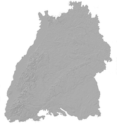
Neben der Erfassung der aktuellen Rohstoffgewinnung werden auch vor 1986 betriebenen Steinbrüche, Ton-, Lehm-, Sand- und Kiesgruben kartiert und dokumentiert. Diese "Altabbaue" treten besonders häufig in Gebieten mit interessanten Lagerstätten auf und geben somit wichtige Hinweise auf die frühere Nutzung und die Qualität der betreffenden Lagerstätte. Außerdem ist es von Bedeutung, bereits abgebaute und verfüllte Bereiche möglichst genau zu erfassen, um Planungen unterschiedlichster Art (künftige Rohstoffgewinnung, zeitweiliger Abbau für die Baudenkmalpflege, Verkehrswegebau, Ausweisung von Baugebieten usw.) zu unterstützen. Kleine Altabbaue (< 0,5 ha) werden nur mit ihrer Lagekoordinate (ohne Polygon) erfasst. Stand: Publikation der jeweiligen KMR50
 Metainformationssystem GDI-BW