Metainformationssystem GDI-BW
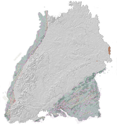
LGRB-BW 3D: Schichtlagerung der Tertiärbasis
Die Karte zeigt die Raumlage der Tertiärbasis. Ergänzend sind der Ausstrich, die Verbreitung, überregionale bruchtektonische Elemente und eine Auswahl von Belegpunkten abgebildet.
Simple
- Alternate title
-
3D: Schichtlagerung der Tertiärbasis
- Date (Revision)
- 2007-12-31
- Citation identifier
- https://meta.lgrb-bw.de/geonetwork/srv/de/csw?SERVICE=CSW&VERSION=2.0.2&REQUEST=GetRecordById&outputschema=csw:IsoRecord&elementsetname=full&ID=f088618d-bbd7-4511-836b-9408f5f3a7be
- Status
- Completed
- Point of contact
-
Organisation name Individual name Electronic mail address Role Regierungspräsidium Freiburg - Abteilung 9 Landesamt für Geologie, Rohstoffe und Bergbau, Ref. 91 Geowissenschaftliches Landeservicezentrum
Point of contact
- Keywords
-
-
Geologie
-
-
GDI-BW-Schlüsselwortliste nach dem mehrsprachigen Umwelt-Thesaurus GEMET
-
-
Geologie
-
Simulation
-
- Use constraints
- Other restrictions
- Other constraints
- Language
- Deutsch
- Character set
- UTF8
))
- Supplemental Information
-
Die Raumlage der Tertiärbasis ist als Übersichtsdarstellung gedacht und wurde auf der Grundlage ausgesuchter Stützstellen nach bestem Wissen konstruiert. Es wird jedoch keine Gewähr für die Vollständigkeit, Richtigkeit, Aktualität oder Qualität übernommen. Die Karten sind urheberrechtliches Eigentum des RP Freiburg, Abt. 9 LGRB und dürfen nur mit Quellenangabe genutzt werden.
- Reference system identifier
- EPSG / EPSG:25832
- Reference system identifier
- EPSG / EPSG:31467
- Reference system identifier
- EPSG / EPSG:4326
- Reference system identifier
- EPSG / EPSG:3857
Distributor
- Distributor contact
-
Organisation name Individual name Electronic mail address Role Regierungspräsidium Freiburg - Abteilung 9 Landesamt für Geologie, Rohstoffe und Bergbau, Vertrieb
Point of contact
- Fees
-
Daten nicht im Vertrieb, Verfügbarkeit/Preis auf Anfrage
- Ordering instructions
- OnLine resource
-
Protocol Linkage Name https://services.lgrb-bw.de/index.phtml?REQUEST=GetCapabilities&VERSION=1.3.0&SERVICE=WMS&SERVICE_NAME=lgrb_gu500 WMS LGRB-BW 3D: Geologisches 3D-Landesmodell 1 : 500 000
- Hierarchy level
- Dataset
Metadata
- File identifier
- f088618d-bbd7-4511-836b-9408f5f3a7be XML
- Metadata language
- Deutsch
- Character set
- UTF8
- Hierarchy level
- Dataset
- Date stamp
- 2021-05-05T17:08:23
- Metadata standard name
-
ISO 19115:2003 (GDI-BW)
- Metadata standard version
-
2.1
- Metadata author
-
Organisation name Individual name Electronic mail address Role Regierungspräsidium Freiburg - Abteilung 9 Landesamt für Geologie, Rohstoffe und Bergbau, Referat 91 Geowissenschaftliches Landeservicezentrum
Point of contact