Metainformationssystem GDI-BW
Naturraum
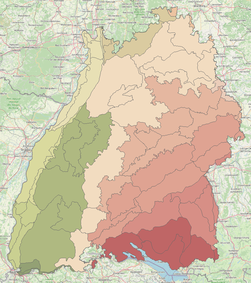
Als "naturräumliche Einheit" bzw. als "Naturraum" wird im geographischen Sinne ein "nach dem Gesamtcharakter seiner Landesnatur abgegrenzter Erdraum" verstanden. Zur Ausweisung werden Faktoren wie Relief, Vegetation, Gewässer, Geologie und Klima herangezogen. Die "Geographische Landesaufnahme 1:200 000 Naturräumliche Gliederung Deutschlands" des Bundesamtes für Landeskunde und Raumforschung wurde für Baden-Württemberg 1991 abgeschlossen.
Simple
- Alternate title
-
naturräumliche Einheit
- Date (Revision)
- 2006-06-12T01:00:00.000+02:00
- Citation identifier
- https://registry.gdi-de.org/id/de.bw.lubw.mdk/c7f1726e-ee4b-4ce6-bba7-75faf0d282b9
- Purpose
-
-
- Status
- Completed
- Point of contact
-
Organisation name Individual name Electronic mail address Role LUBW Landesanstalt für Umwelt Baden-Württemberg
UIS-Geodatenmanagement, RIPS-Metadaten
Point of contact LUBW Landesanstalt für Umwelt Baden-Württemberg
Flächenschutz
Point of contact
- Maintenance and update frequency
- Not planned
- Update scope
- Dataset
- Maintenance note
-
Aktuelle Karte
- Keywords
-
-
Landschaftsplanung
-
Naturschutz
-
- Keywords
-
-
oac: 69
-
- Use constraints
- Other restrictions
- Other constraints
-
Es gelten die Bedingungen der Nutzungsvereinbarung für Daten des UIS " https://www.lubw.baden-wuerttemberg.de/umweltinformationssystem/nutzungsvereinbarung"
- Spatial representation type
- Vector
- Denominator
- 200000
- Language
- Deutsch
- Character set
- UTF8
- Topic category
-
- Biota
- Environment description
-
Naturschutzinformationssystem (NAIS)
- Description
-
Baden-Württemberg
- Extent type code
- Yes
- Geographic identifier
- Raumbezug des Datensatzes
))
- Unique resource identifier
- EPSG 25832: ETRS89 / UTM Zone 32N
- Topology level
- Full surface graph
- Geometric object type
- Surface
- Geometric object count
- 66
- Distribution format
-
Name Version
Distributor
- Distributor contact
-
Organisation name Individual name Electronic mail address Role LUBW Landesanstalt für Umwelt Baden-Württemberg
UIS-Geodatenmanagement, RIPS-Datenabgabe
Distributor
- Ordering instructions
-
Gebuehren: kostenlos bzw. nach Bereitstellungsaufwand
- OnLine resource
-
Protocol Linkage Name https://udo.lubw.baden-wuerttemberg.de/public/
- OnLine resource
-
Protocol Linkage Name https://rips-datenlink.lubw.de/UDO_download/NaturraeumlicheGliederung.zip Geodaten-Download: Naturräumliche Gliederung
- OnLine resource
-
Protocol Linkage Name OGC Web Feature Service https://rips-gdi.lubw.baden-wuerttemberg.de/arcgis/services/wfs/Naturraum/MapServer/WFSServer?request=GetCapabilities&service=WFS Dienst "WFS Naturraum" (GetCapabilities)
- OnLine resource
-
Protocol Linkage Name OGC Web Map Service https://rips-gdi.lubw.baden-wuerttemberg.de/arcgis/services/wms/UIS_0100000006900001/MapServer/WMSServer?REQUEST=GetCapabilities&SERVICE=WMS Dienst "WMS Naturraum" (GetCapabilities)
- Hierarchy level
- Dataset
- Statement
-
-
- Description
-
Als "naturräumliche Einheit" bzw. als "Naturraum" wird im geographischen Sinne ein "nach dem Gesamtcharakter seiner Landesnatur abgegrenzter Erdraum" verstanden. Zur Ausweisung werden Faktoren wie Relief, Vegetation, Gewässer, Geologie und Klima herangezogen.
Die "Geographische Landesaufnahme 1:200 000 Naturräumliche Gliederung Deutschlands" des Bundesamtes für Landeskunde und Raumforschung wurde für Baden-Württemberg 1991 abgeschlossen.
Metadata
- File identifier
- c7f1726e-ee4b-4ce6-bba7-75faf0d282b9 XML
- Metadata language
- Deutsch
- Character set
- UTF8
- Hierarchy level
- Dataset
- Date stamp
- 2026-04-15
- Metadata standard name
-
ISO19115
- Metadata standard version
-
2003/Cor.1:2006
- Metadata author
-
Organisation name Individual name Electronic mail address Role LUBW Landesanstalt für Umwelt Baden-Württemberg
UIS-Geodatenmanagement, RIPS-Metadaten
Point of contact