Metainformationssystem GDI-BW
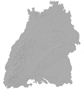
LGRB-BW GK50: Erz und Mineralgänge
Tektonische Störungen mit Gangartmineralen und wechselnden Gehalten an Erzen. Typische Mineralgänge sind Fluss- und Schwerspat sowie Quarzgänge. Werden Gänge aufgrund ihres hohen Metallgehalts als wirtschaftlich interessant angesehen, spricht man von Erzgängen.
Simple
- Alternate title
-
GK50: Erz und Mineralgänge
- Date (Revision)
- 2013-01-01
- Status
- On going
- Point of contact
-
Organisation name Individual name Electronic mail address Role Regierungspräsidium Freiburg - Abteilung 9 Landesamt für Geologie, Rohstoffe und Bergbau, Ref. 92 Landesgeologie
Point of contact
- Maintenance and update frequency
- Biannually
- Keywords
-
-
Geodaten
-
-
Liste der Datenkategorien in der GDI-BW für Geodaten
-
-
opendata
-
-
GDI-BW-Schlüsselwortliste nach dem mehrsprachigen Umwelt-Thesaurus GEMET
-
-
Geologie
-
- Use constraints
- Other restrictions
- Language
- Deutsch
- Character set
- UTF8
))
- Reference system identifier
- EPSG:25832
- Reference system identifier
- EPSG:31467
- Reference system identifier
- EPSG:4326
- Reference system identifier
- EPSG:3857
- Reference system identifier
- EPSG:4258
- Distribution format
-
Name Version ESRI Shapefile
n/a (default)
GeoPackage
n/a (default)
Distributor
- Distributor contact
-
Organisation name Individual name Electronic mail address Role Regierungspräsidium Freiburg - Abteilung 9 Landesamt für Geologie, Rohstoffe und Bergbau, Vertrieb
Distributor
- Fees
-
Die Daten werden unter der Datenlizenz Deutschland - Namensnennung - Version 2.0 - www.govdata.de/dl-de/by-2-0 angeboten.
Die Namensnennung hat in folgender Weise zu erfolgen: Datenquelle: Regierungspräsidium Freiburg - LGRB, www.lgrb-bw.de
- Ordering instructions
- OnLine resource
-
Protocol Linkage Name https://services.lgrb-bw.de/ms/lgrb_geola_geo?REQUEST=GetCapabilities&SERVICE=WMS&VERSION=1.3.0 WMS GetCapabilities Anfrage, welche maschinenlesbare Metadaten zum Datensatz bereitstellt
- Hierarchy level
- Dataset
- Statement
-
Integrierte Geowissenschaftliche Landesaufnahme (GeoLa)
Metadata
- File identifier
- 9a96c733-060c-4473-b1bf-764a3fa5e90b XML
- Metadata language
- Deutsch
- Character set
- UTF8
- Hierarchy level
- Dataset
- Date stamp
- 2025-12-19T08:15:08
- Metadata standard name
-
ISO 19115:2003 (GDI-BW)
- Metadata standard version
-
2.1
- Metadata author
-
Organisation name Individual name Electronic mail address Role Regierungspräsidium Freiburg - Abteilung 9 Landesamt für Geologie, Rohstoffe und Bergbau, Referat 91 Geowissenschaftliches Landeservicezentrum
Point of contact