Metainformationssystem GDI-BW
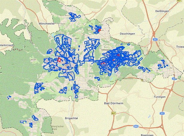
WFS Dienst der Geltungsbereiche der Bebauungspläne der Stadt Villingen-Schwenningen
Der Download-Dienst bietet eine Zugriffsmöglichkeit auf die Geltungsbereiche der rechtskräftigen Bebauungspläne der Stadt Villingen-Schwenningen. Als Attribute sind neben den Informationen zum Namen, Nummer, Inkrafttretungsdatum, … auch der WMS-Dienst Link etc. hinterlegt. Zusätzliche Informationen findet man in der Bebauungsplan-App der Stadt
Simple
Identification info
- Date (Publication)
- 2022-12-22T12:00:00
- Citation identifier
- https://www.villingen-schwenningen.de/bauen-wohnen/vermessung/geoportal-villingen-schwenningen
- Point of contact
-
Organisation name Individual name Electronic mail address Role Stadt Villingen-Schwenningen - Stadtplanungsamt
Publisher
- Theme
-
-
Dienst für den Zugriff auf Objekte
-
Bauleitplan
-
Web Feature Service
-
Bebauung
-
Villingen-Schwenningen
-
-
GEMET - INSPIRE themes, version 1.0
-
-
Bodennutzung
-
- Keywords
-
- Use limitation
-
Nutzungsbedingungen: Es gelten keine Bedingungen
- Access constraints
- Other restrictions
- Use constraints
- License
- Other constraints
- Es gelten keine Zugriffsbeschränkungen
- Other constraints
-
Nutzungsbedingungen: Es gelten die Lizenzbedingungen "Datenlizenz Deutschland – Namensnennung – Version 2.0" ( https://www.govdata.de/dl-de/by-2-0) mit folgender Quellenangabe: "Datengrundlage: Stadt Villingen-Schwenningen.de."
- Other constraints
-
{"id": "dl-by-de/2.0", "name": "Datenlizenz Deutschland Namensnennung 2.0", "url": " https://www.govdata.de/dl-de/by-2-0", "quelle": "Datengrundlage: Stadt Villingen-Schwenningen.de."}
- Service Type
- download
- Service Version
-
OGC:WFS 2.0
))
- Coupled Resource
-
Operation Name Scoped name Identifier GetCapabilities
undefined
- Coupling Type
- Tight
- Reference system identifier
- ETRS / UTM 32N: EPSG: 25832
- Reference system identifier
- urn:ogc:def:crs:EPSG / EPSG:4326
- Distribution format
-
Name Version ESRI Shapefile
1.0
- OnLine resource
-
Protocol Linkage Name WWW:LINK-1.0-http--link
https://apps.villingen-schwenningen.de/mapservervs/getcapbplan.php?map=Bplan_Geltungsbereich.map&SERVICE=WFS&VERSION=2.0&REQUEST=GetCapabilities Geltungsbereiche der Bebauungspläne
WWW:LINK-1.0-http--link
https://apps.villingen-schwenningen.de/portal/Bauleitplaene Bebauungsplan-App der Stadt Villingen-Schwenningen
- Hierarchy level
- Service
- Other
-
Geodatendienst
Domain consistency
- Measure identification
- VERORDNUNG (EG) Nr. 976/2009 DER KOMMISSION vom 19. Oktober 2009 zur Durchführung der Richtlinie 2007/2/EG des Europäischen Parlaments und des Rates hinsichtlich der Netzdienste
Conformance result
- Title
-
VERORDNUNG (EG) Nr. 976/2009 DER KOMMISSION vom 19. Oktober 2009 zur Durchführung der Richtlinie 2007/2/EG des Europäischen Parlaments und des Rates hinsichtlich der Netzdienste
- Date (Publication)
- 2009-10-20
- Citation identifier
- http://eur-lex.europa.eu/LexUriServ/LexUriServ.do?uri=OJ:L:2009:274:0009:0018:DE:PDF
- Explanation
-
siehe Spezifikation
- Pass
- No
Metadata
- File identifier
- 96bdd3e7-a68e-4d73-8887-cbb606a7bb99 XML
- Date stamp
- 2023-11-20T08:23:24
- Metadata standard name
-
ISO 19115:2003, 19119:2006 (GDI-BW)
- Metadata standard version
-
Metadatenprofil GDI-BW 2.1
- Metadata author
-
Organisation name Individual name Electronic mail address Role Stadt Villingen-Schwenningen - Vermessungsamt
Point of contact