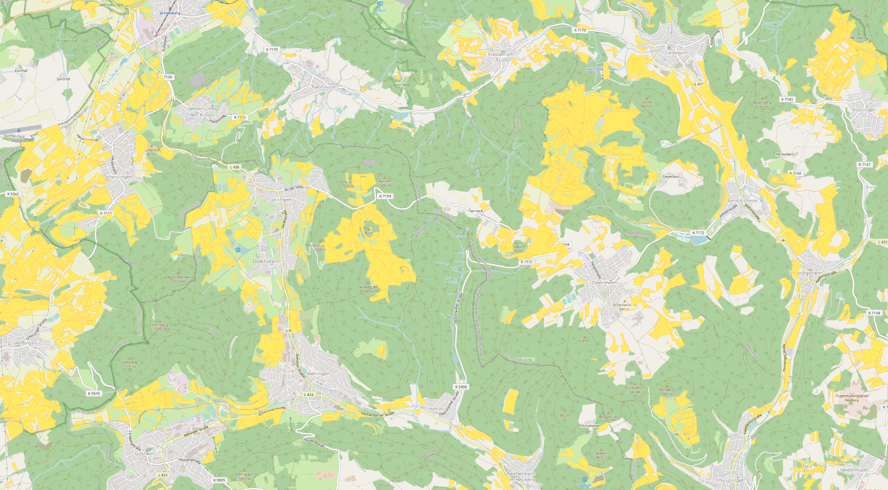
WMS FFH-Mähwiese
Darstellungsdienst zu FFH-Mähwiese
Simple
Identification info
- Date (Creation)
- 2013-11-07T00:00:00.000+01:00
- Purpose
-
Die FFH-Richtlinie ist eine Naturschutz-Richtlinie der EU, deren Name sich von Fauna (= Tiere), Flora (= Pflanzen) und Habitat (= Lebensraum) ableitet. Wesentliches Ziel ist die Erhaltung der biologischen Vielfalt durch den Aufbau eines Schutzgebietssystems für die Lebensraumtypen des Anhangs I und die Arten des Anhangs II der Richtlinie. Außerdem werden die Erhaltungszustände der Lebensraumtypen und Arten (Anhang II, IV, V) überwacht.
- Status
- On going
-
UMTHES Thesaurus
-
-
Naturschutz
-
-
Service Classification, version 1.0
-
-
infoMapAccessService
-
- Use constraints
- Other restrictions
- Other constraints
- Es gelten keine Bedingungen
- Service Type
- view
- Service Version
-
OGC:WMS 1.3.0
- Description
-
Baden-Württemberg
- Extent type code
- Yes
- Geographic identifier
- Raumbezug des Datensatzes
))
Coupled Resource
- Operation Name
-
GetCapabilities
- Coupling Type
- Tight
Contains Operations
- Operation Name
-
GetCapabilities
- Distributed Computing Platforms
- Web services
- Operation Description
-
Liefert Meta-Informationen zu einem Service, wie z.B. Adresse des Herausgebers, verfügbare Operationen, Eigenschaften der Kartenlayer, unterstützte Raumbezugssystem u.a.
- Operates On
- Unique resource identifier
- EPSG 25832: ETRS89 / UTM Zone 32N
- Distribution format
-
Distributor
- Ordering instructions
-
Gebuehren: kostenlos bzw. nach Bereitstellungsaufwand
- OnLine resource
- Dienst "WMS FFH-Mähwiese" (GetCapabilities)
- File identifier
- 947a0af5-16f0-4caf-bd2d-cb43f39479d3 XML
- Metadata language
- Deutsch
- Character set
- UTF8
- Hierarchy level
- Service
- Hierarchy level name
-
service
- Date stamp
- 2024-07-26
- Metadata standard name
-
ISO 19115:2003 (GDI-BW)
- Metadata standard version
-
2.1
Overviews

Spatial extent
))
Provided by

 Metainformationssystem GDI-BW