Metainformationssystem GDI-BW
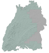
LGRB-BW GK50: Bearbeitetes Gebiet (GeoLa)
Die Geologische Grundkarte (GK50) stellt den aktuellen Kenntnisstand des geologischen Baus von Baden-Württemberg im mittleren Maßstabsbereich dar. Die GK50 gliedert sich dabei in die Datenebenen der flächenhaften geologischen Einheiten von Locker- und Festgesteinen, der geologischen Überlagerungen jüngerer Sedimente, linienhafte geologische Einheiten (geologische Bänke), Tektonik (strukturgeologische Linien) sowie Erz- und Mineralgänge.
Die geologischen Informationen der GK50 beziehen sich auf die Geländeoberfläche (Oberflächenkarte), dienen darüber hinaus auch als Datengrundlage für das Geologische 3D-Landesmodell sowie für die Geologischen Übersichtskarten (M200, M500 u. M1000), die aus der GK50 durch einen automatisierten Workflow abgeleitet werden. Die Daten der GK50 liefern somit relevante Informationen über den Aufbau und die Eigenschaften des Untergrundes. Die geologische Information der GK50 bildet unter anderem die Grundlage zur Beurteilung der Bodenbildung, des Baugrunds und ingenieurgeologischer Gefahrenhinweise, zur Ableitung hydrogeologischer Karten sowie rohstoffgeologisch relevanter Datensätze.
Alle Datenebnen der GK50 liegen landesweit vor und werden laufend fortgeschrieben. Neue Erkenntnisse, die u. a. durch Bohrprojekte und kleinräumige Kartierungen entstehen, werden aktiv in den Datensatz eingepflegt.
Die GK50 wurde im Rahmen der Integrierten Geowissenschaftlichen Landesaufnahme (GeoLa) in den Jahren 2003 bis 2015 erstellt. Die Grundlage der GK50 bilden Daten unterschiedlicher Herkunft. Im Wesentlichen sind es die Inhalte der GK25 Karten, die durch wenige GK50-Umgebungskarten (z.B. von Stuttgart, Heilbronn, Schwäbisch-Fränkischer Wald u.a.) ergänzt wurden. Die geologischen Datensätze beziehen sich auf eine landesweit harmonisierte Generallegende, die eine Teilmenge des Symbolschlüssels von BW darstellt.
Simple
- Alternate title
-
GK50: Bearbeitetes Gebiet (GeoLa)
- Date (Revision)
- 2013-01-01
- Status
- On going
- Point of contact
-
Organisation name Individual name Electronic mail address Role Regierungspräsidium Freiburg - Abteilung 9 Landesamt für Geologie, Rohstoffe und Bergbau, Ref. 92 Landesgeologie
Point of contact
- Maintenance and update frequency
- Biannually
- Keywords
-
-
Geodaten
-
-
Liste der Datenkategorien in der GDI-BW für Geodaten
-
-
opendata
-
-
GDI-BW-Schlüsselwortliste nach dem mehrsprachigen Umwelt-Thesaurus GEMET
-
-
Geologie
-
- Use constraints
- Other restrictions
- Language
- Deutsch
- Character set
- UTF8
))
- Reference system identifier
- EPSG:25832
- Reference system identifier
- EPSG:31467
- Reference system identifier
- EPSG:4326
- Reference system identifier
- EPSG:3857
- Reference system identifier
- EPSG:4258
- Distribution format
-
Name Version ESRI Shapefile
n/a (default)
GeoPackage
n/a (default)
Distributor
- Distributor contact
-
Organisation name Individual name Electronic mail address Role Regierungspräsidium Freiburg - Abteilung 9 Landesamt für Geologie, Rohstoffe und Bergbau, Vertrieb
Distributor
- Fees
-
Die Daten werden unter der Datenlizenz Deutschland - Namensnennung - Version 2.0 - www.govdata.de/dl-de/by-2-0 angeboten.
Die Namensnennung hat in folgender Weise zu erfolgen: Datenquelle: Regierungspräsidium Freiburg - LGRB, www.lgrb-bw.de
- Ordering instructions
- OnLine resource
-
Protocol Linkage Name https://services.lgrb-bw.de/ms/lgrb_geola_geo?REQUEST=GetCapabilities&SERVICE=WMS&VERSION=1.3.0 WMS GetCapabilities Anfrage, welche maschinenlesbare Metadaten zum Datensatz bereitstellt
- Hierarchy level
- Dataset
- Statement
-
Integrierte Geowissenschaftliche Landesaufnahme (GeoLa)
Metadata
- File identifier
- 3f12f980-5f52-11e0-80e3-0800200c9a66 XML
- Metadata language
- Deutsch
- Character set
- UTF8
- Hierarchy level
- Dataset
- Date stamp
- 2025-12-19T08:15:04
- Metadata standard name
-
ISO 19115:2003 (GDI-BW)
- Metadata standard version
-
2.1
- Metadata author
-
Organisation name Individual name Electronic mail address Role Regierungspräsidium Freiburg - Abteilung 9 Landesamt für Geologie, Rohstoffe und Bergbau, Referat 91 Geowissenschaftliches Landeservicezentrum
Point of contact