Metainformationssystem GDI-BW
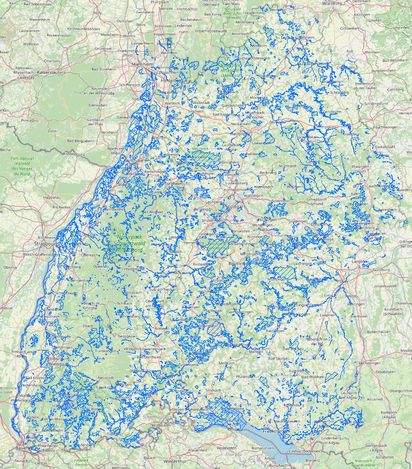
WMS FFH-Gebiet
Natura 2000 ist ein Netz von Schutzgebieten zur Erhaltung europäisch bedeutsamer Lebensräume sowie seltener Tier- und Pflanzenarten. Die rechtliche Grundlage dieses grenzüberschreitenden Naturschutznetzwerks bilden die Vogelschutz- und die Fauna-Flora-Habitat (FFH)-Richtlinie der Europäischen Union. Nach den Vorgaben der FFH-Richtlinie benennt jeder Mitgliedstaat Gebiete, die für die Erhaltung seltener Tier- und Pflanzenarten sowie typischer oder einzigartiger Lebensräume von europäischer Bedeutung wichtig sind. Maßstäbe: 1:1500, 1:25000
Simple
Identification info
- Date (Creation)
- 2011-01-11T00:00:00.000+01:00
- Purpose
-
-
- Status
- Completed
- Point of contact
-
Organisation name Individual name Electronic mail address Role LUBW Landesanstalt für Umwelt Baden-Württemberg
UIS-Geodatenmanagement, RIPS-Metadaten
Point of contact LUBW Landesanstalt für Umwelt Baden-Württemberg
UIS-Geodatenmanagement, RIPS-Datenabgabe
Distributor
-
UMTHES Thesaurus
-
-
Artenschutz
-
Naturschutz
-
Biotopschutz
-
-
Service Classification, version 1.0
-
-
infoMapAccessService
-
- Use constraints
- Other restrictions
- Other constraints
- Es gelten keine Bedingungen
- Service Type
- view
- Service Version
-
OGC:WMS 1.3.0
- Description
-
Baden-Württemberg
- Extent type code
- Yes
- Geographic identifier
- Raumbezug des Datensatzes
))
- Coupled Resource
-
Operation Name Scoped name Identifier GetCapabilities
https://registry.gdi-de.org/id/de.bw.lubw.mdk/2e5c0d70-f6d7-4c90-83a9-12fafed44b0e
- Coupling Type
- Tight
- Contains Operations
-
Operation Name Distributed Computing Platforms Connect Point GetCapabilities
Web services https://rips-gdi.lubw.baden-wuerttemberg.de/arcgis/services/wms/UIS_0100000013100001/MapServer/WMSServer?REQUEST=GetCapabilities&SERVICE=WMS
- Operates On
- Unique resource identifier
- EPSG 25832: ETRS89 / UTM Zone 32N
- Distribution format
-
Name Version
Distributor
- Distributor contact
-
Organisation name Individual name Electronic mail address Role LUBW Landesanstalt für Umwelt Baden-Württemberg
UIS-Geodatenmanagement, RIPS-Datenabgabe
Distributor
- Ordering instructions
-
Gebuehren: kostenlos bzw. nach Bereitstellungsaufwand
- OnLine resource
-
Protocol Linkage Name https://rips-gdi.lubw.baden-wuerttemberg.de/arcgis/services/wms/UIS_0100000013100001/MapServer/WMSServer?REQUEST=GetCapabilities&SERVICE=WMS Dienst "WMS FFH-Gebiet" (GetCapabilities)
Metadata
- File identifier
- 3d453fa6-450f-4ea4-a608-ec0cfe69d182 XML
- Metadata language
- Deutsch
- Character set
- UTF8
- Hierarchy level
- Service
- Hierarchy level name
-
service
- Date stamp
- 2024-07-26
- Metadata standard name
-
ISO 19115:2003 (GDI-BW)
- Metadata standard version
-
2.1
- Metadata author
-
Organisation name Individual name Electronic mail address Role LUBW Landesanstalt für Umwelt Baden-Württemberg
Point of contact